


About the Wahroonga Electorate
Location
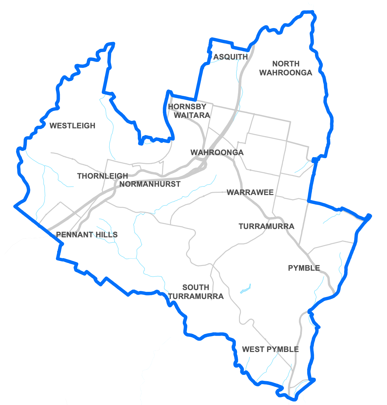
The electorate of Wahroonga is located in the northern Suburbs of Sydney and stretches 50 square kilometres from Pymble to Pennant Hills. The electorate was formerly named Ku-ring-gai.
The Wahroonga electorate has an enrolment of around 58,500 (2023).
Take a look at the District Profile of Wahroonga.
Suburbs
The electorate covers all or part of the suburbs of Asquith*, Hornsby*, Normanhurst*, North Wahroonga, Pennant Hills*, Pymble*, South Turramurra, St Ives*, Thornleigh, Turramurra*, Wahroonga, Waitara, Warrawee, West Pymble and Westleigh (* denotes partial suburb).
About
The electorate is the only NSW electorate to have produced two Liberal Premiers; the Hon Nick Greiner and the Hon Barry O’Farrell.
Former Attorney General John Maddison was the first Member for Ku-ring-gai, serving from 1973 until 1980.
Ku-ring-gai is a modified name that originated from the original inhabitants, the Guringgai Aboriginal group. Kuringgai means ‘belonging to the aborigines’. The First dated European settlement goes back to 1814, when William Henry farmed the land near the Lane Cove River. Agriculture dominated the area until the opening of the North Shore Railway Line in 1890 leading to an increase in land being used for residential purposes. In 1894, the tribal name was adapted at the creation of the Ku-ring-gai Chase National Park.
The Wahroonga Electorate is known for its national parks, public parks, bushlands and reserves.
The area also offers an extensive selection of educational options, with around 30 independent, catholic and public schools found in the electorate.
